

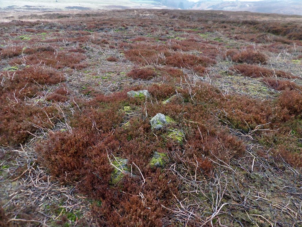
The Old Wife's Neck is a short standing stone located on Sneaton Low Moor, 5 miles to the south of Whitby.
This is another North Yorks Moors location associated with the folklore figure of the 'Old Wife' (see also The Old Wife of Lund Ridge). It also continues the Old Wife's association with prehistoric sites, as this stone is part of an ancient bank and ditch earthwork running across the moor. Four parallel banks run for 750m on an east/west alignment, with several upright stones located along the banks. More stones are said to have existed on the banks in the past but these have since been removed. It has also been suggested that a stone row may have originally stood on the same alignment, and these stones were incorporated into the later earthworks.
The 1893 edition OS map marks over 200 small tumuli clustering on the south side of the earth works, with several hundred more spread across the moorland on the north side. These tumuli take the form of small cairns, and so the Old Wife's link with this site mirrors the situation with the cairn field at Lund Rigg. The purpose of these small cairns is a little unclear, and when no burial remains are found within them the default suggestion is that they are stone clearance for cultivation. However, it has also been pointed out that organic remains are unlikely to survive beneath cairns in an acidic moorland environment. In the Sami culture of Northern Scandinavia, small cairns were also used as votive sites, and on Sneaton Moor, the clustering of the cairns next to the earthworks and standing stones might suggest some ritual or religious purpose.

|
| Stones, earthworks, and cairns - OS Map (1983) Map credit NLS. |
Uncertainty also extends to the purpose of the cross ridge earthworks
themselves, with the suggestion being that they were territorial boundary
markers, although this is not entirely convincing in this case given the mass
of cairns clustering around them. Blaise Vyner's study of this type of
earthwork monument led him to conclude that they defined smaller, ritual areas
(Vyner, 1995). In this respect it is worth noting that the orientation of the
main section of the earthworks 'points' due east towards Stoupe Brow hill on
the coast, this hilltop being the location of a group of large burial mounds
and the largest concentration of prehistoric rock carvings in the region. When
viewed from the earthworks, the sun would also rise over Stoupe Brow at
certain times of the year. The eastern section of the earthworks also come to
an end at a point where the view of Stoupe Brow disappears below an
intervening ridge.
If the earthworks did form a boundary to a
ritual area, then the southern boundary may have been the stream gully of
Biller Howe Slack - where the cairn field ends. Biller is thought to mean
something like 'the woman's clearing', from the Old Norse word 'bil' meaning
woman. This is of interest in relation to the Old Wife name, as in the past,
'wife' simply meant a woman (rather than a married woman), and it is also
worth noting that 'Bell' (Bil?) is another name given to the Old Wife. The
stream of Biller Howe Slack runs east, before flowing southward to eventually
join the river Derwent. The modern OS map shows that this stream could actually be the true
source of the river Derwent, so it may have been regarded as such in the past.
The OS map also shows that the earthworks and associated cairn fields are spread across the high ground at the head of the Kirkmoor/Ramsdale beck. This is the main watercourse running down into Robin Hood's Bay, where it flows into the sea at Boggle Hole. If the prehistoric remains in this area were connected with a coastal community based in the bay, then they may have regarded this as a significant 'watery' location, being the source of both a major river, and the waters flowing down into the bay and the sea beyond.
On the north side of the earthworks the cairn field stretches across the open moorland, eventually fading to just a few isolated burial mounds in an area called Greystone Hills and Standing Stones Rigg. This area is the site of another Old Wife standing stone, the remains of the Ramsdale Stone circle, and further north, another cross ridge earthwork at Latter Gate Hills. From the number of prehistoric monuments that have survived on this section of the coast, it is possible that they may have formed a 'chain' of such sites along the higher ground around the bay.

What's in a name?
The 'Old Wife's Neck' is said to refer to the shape of the standing
stone, which, when viewed from the west side, resembles the profile of a
woman's head and shoulders. The name confirms the Old Wife's connection with
this site, but why would the name refer just to her neck rather than the 'Old
Wife's head?
As mentioned in the
Cailleach an Dùdain
post, the Old Wife appears to be a 'relative' of the Cailleach mythological
figure found in Scotland and Ireland, where significantly more folklore has
survived about these ancient legendary women.
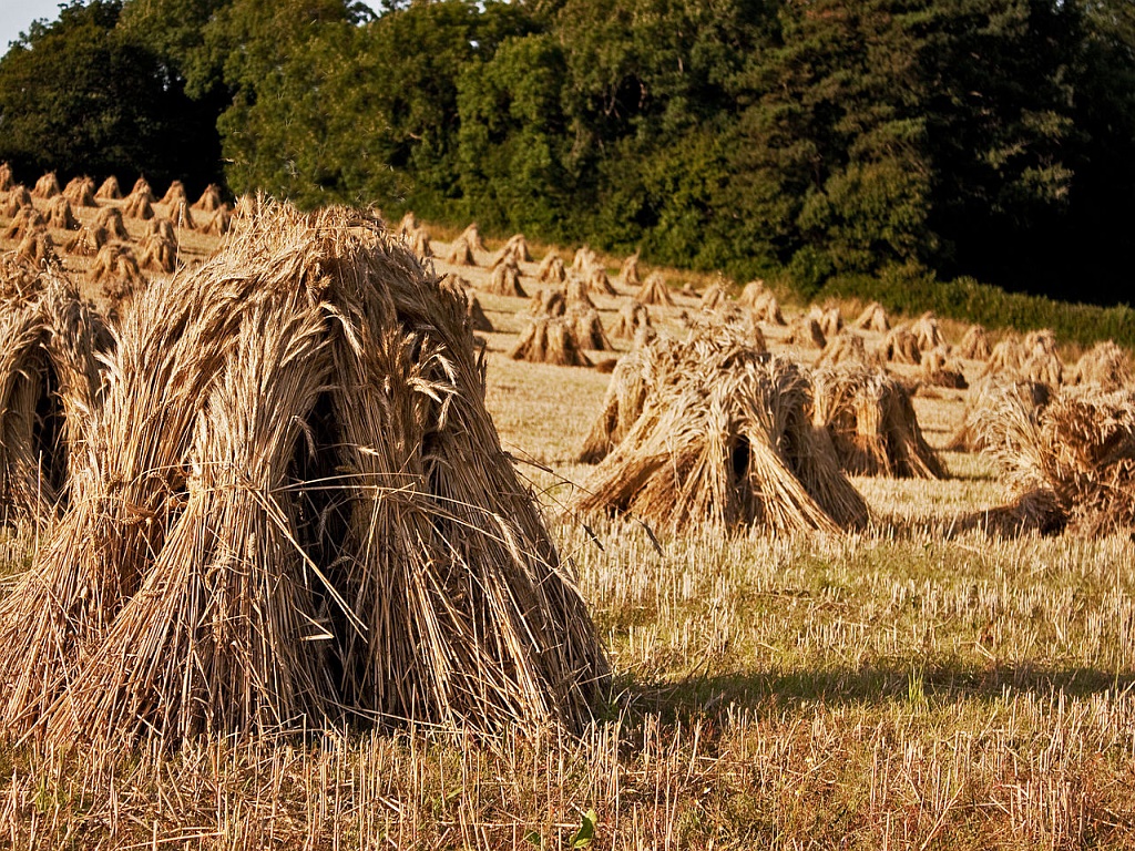
In Scotland, the Cailleach is closely connected with the harvest, where the last sheaf on a farm used to be ritually cut, and then made into a Corn Dolly type figure called the Cailleach, which was then kept in the farm house for good luck. In Wales, the last sheaf was also cut in a ritual manner and made into a figure called the Mare or Y Gwrach (the Hag), another supernatural female, possibly connected with the Cailleach/Old Wife. In Cornwall, Devon and Somerset the same ritual took place, but the last sheaf was called the 'Neck' and was held aloft to shouts of "I have her - i have her - i have her". Joseph Wright (1903) provides several examples of this rural custom, and lists a reference to the same practice taking place in Yorkshire. It can be no coincidence that 'Nek' is the Norse/Scandinavian word for a harvested sheaf, and so its use in the north of England would not be unexpected, but how the word came to be part of a Cornish tradition is not so clear. In Scandinavian countries the Jule-Nek sheaf was saved until Christmas Eve, and then hung up outside on the highest part of the farmhouse or on a tall pole. This sheaf was raised aloft for luck and a good harvest in the coming year. Omens were also drawn from the kind of birds which came first to the Jule-nek to feed on the grains.

As noted above, in Scotland the last sheaf 'became' the Cailleach. If this tradition also prevailed, in the north of England then the last 'Nek' would become the Old Wife.
Is this the origin of the Old Wife's Neck name?
Looking again at the shape of the stone, when viewed for its east side, there is a resemblance to a harvested sheaf - where a band is tied around a bundle of grain stalks and pulled tight to form a 'neck'. If this was the case, then it provides another link between the Old Wife and the Cailleach. Just as the last sheaf became the Cailleach when it was formed into a human figure, here the Old Wife's stone has both the form of a sheaf and a woman.
Or did the shape of the Old Wife's Stone suggest a harvest sheaf left
as an offering to the Old Wife? In parts of Germany the last sheaf was left in
the field as an offering and called 'Vergodendeels struus' meaning 'lord
Woden's straw share'. In parts of Sweden a harvest sheaf was left in the field
for 'Odin's Horse', and again in Germany a medieval account mentions an
invocation spoken over the last sheaf - "Wode, Hale dynem Rosse nun Voder",
meaning 'Wode fetch now thy horse fodder'. Jacob Grimm's
Germanic Mythology (1835) highlights the confusion of names by which
the original reverence for a female 'bestower of the harvest' - in some places
called 'Frau Wode' (ie. Wode's Wife - Frigg/Jord), eventually transferred to
Wode/Woden himself. 'Wode's Wife' is of interest in relation to the North York
Moors, where the Old Wife is also refered to as 'Wade's Wife' - her husband
being the giant called 'Wade'.


After - thoughts
Would the sunrise up the slope of Stoupe Brow?
As cairns formed from stones dropped by the Old Wife - earthworks created by
her dragging/raking?
A harvest sheaf turned to stone?
A field of cairns - a field of stooks (stacked sheaves)?
Boggle Hole in Robin Hood's Bay and Hob Hole in Runswick Bay?
References
Grimm, J. (1835) Deutsche Mythologie.
Wright, J. (1903) The English Dialect Dictionary, vol 4.
NLS - Map reproduced with the permission of the National Library of
Scotland.
Vyner, B. (1995) Moorland Monuments' in The Brides Of Place: Cross-Ridge
Boundaries Reviewed.
Links
As with many sites in this region i can see
Gavin Parry's
footprints ahead of me.
Wonderful read - and fascinating untangling of possible meanings
ReplyDeleteThanks - When the folklore of a site has been lost and we only have the name, i think it is worthwhile putting forward some idea's and suggestions - to show the possibilities at least.
DeleteI don't want to sound mundane, but is there any chance it's a corruption of "Wife's Sneck"?
ReplyDeleteI had not thought of Sneck - i quite like it. Do you mean nose or door latch? Being a Yorkshireman i have heard "keep your sneck out!" in the past. The meanings all seem to relate to the shape or parts of those old fashioned door latches. Would it be the Old Wife's nose or Old Wife's door latch?
DeleteGreat stuff, Graeme. One of my favourite spots. Pat O'Halloran
ReplyDeleteThanks Pat - I'm sure you know the place well. It was a bit wet and overcast when i went, but still worth it.
DeleteThat's really interesting - it's not a place I've visited. I was exploring a part of Swaledale over the summer though, where there was a fort, a stone circle (not marked as such on the map) and various earthworks.
ReplyDeleteThanks for your comment - definitely worth a look if you are in the area.
Delete