|
|
1854 OS map
(Map credit NLS) |
Thornthwaite township is a scattered community spread along the Padside Beck valley, 8 miles to the west of Harrogate.
The first edition OS map (1854) marks a Rocking Stone at Rowantree Crags
on the high ground to the south west of Thornthwaite. The Rocking Stone does
not appear on later edition maps, which ominously mark a quarry at the same
location. However, overlaying the old OS map onto a modern satellite image
seemed to show that a large rock still existed at the location marked for the
Rocking Stone. Was it possible that the Rocking Stone had survived?
Unfortunately, a visit to the site in Sept 2021 found no sign of the Rocking Stone, and very little sign of the Rowantree Crags, which appear to have been totally quarried away. The piece of rock visible on the satellite image turned out to be an exposed section of bed rock, which for some reason had not been quarried, and curiously, is very close to where the Rocking Stone was located. It is likely that the Rocking Stone sat on a similar section of rock within a few metres of this location.

|
|
Exposed outcrop close to the site of the Rocking Stone |
The only reference to this lost Rocking Stone appears to come from
William Grainge, who noted in his
History of the Forest of Knaresborough....
" On this ridge is a large rocking stone, about seventeen feet in length by
seven feet in breadth in the widest part ; the thickness is five feet six
inches. On the top are four basins, which hold water, the largest of which
is about eighteen inches in diameter by five inches in depth; the others are
smaller. This rests on another large stone, about four feet high, sixteen
feet in length, and five feet in breadth. The rocking motion is easily made,
and is caused by the upper stone resting upon two knobs, about four feet
apart, which act as pivots. There does not appear to be anything artificial
about it. On the top of this range of rocks, which extends for some distance
northward, is a greater number of rock basins than we ever remember to have
seen elsewhere. A splendid view of the country to the eastward is obtained
from this ridge."(Grainge, 1871)
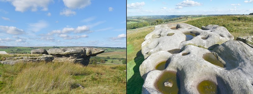
Grainge mentions the numerous rock basins to be found on the crags along this hillside, and some of these can still be seen on the partly quarried Calf Crags, 250m north-west of the Rocking Stone site.

|
|
Calf Crags with rock basins on top |
The OS map surveyors marked the Rocking Stone name in Gothic
Script, which was used to indicate ancient sites and antiquities. This
suggests that they were informed of some local tradition that this was an
ancient site. Elsewhere, such a large rocking stone with basins on top could
easily have been the site of folklore practices connected with healing,
fertility and good luck, but unfortunately nothing has been recorded for the
Rowantree Crags Rocking Stone. The narrow lane leading up from Thornthwaite
towards the Rocking Stone is called 'My love Lane', which might point to a
time when courting couples wandered up the hill to visit the Rocking Stone in
connection with matters of the heart.

|
|
The Rocking Stone on Rocking Moor (3.5 miles west of Thornthwaite) |
After Thoughts
It is interesting to note that the nearest house to the Rowantree Crags
Rocking Stone is called Brandrith House. There is another Rocking Stone at
Brandrith Crags on the moors 1.5 miles to south-west of Thornthwaite.
Looking closely at the old OS map, there seems to have been an attempt
to show the shape of the rocking stone, and the basins on top.
Reference
Grainge, W. (1871) The History and Topography of Harrogate, and the Forest of
Knaresborough.

Post a Comment